


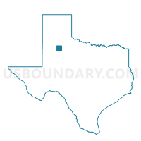
Voting District 0027, Crosby County, Texas
About
Outline

Summary
| Unique Area Identifier | 671813 |
| Name | Voting District 0027 |
| County | Crosby County |
| State | Texas |
| Area (square miles) | 351.12 |
| Land Area (square miles) | 349.65 |
| Water Area (square miles) | 1.47 |
| % of Land Area | 99.58 |
| % of Water Area | 0.42 |
| Latitude of the Internal Point | 33.63659440 |
| Longtitude of the Internal Point | -101.15058620 |
Maps


Graphs
Select a template below for downloading or customizing gragh for Voting District 0027, Crosby County, Texas


Neighbors
Neighoring Voting District (by Name) Neighboring Voting District on the Map
- Voting District 0001, Dickens County, TX
- Voting District 0003, Garza County, TX
- Voting District 0004, Motley County, TX
- Voting District 0004, Dickens County, TX
- Voting District 0011, Crosby County, TX
- Voting District 0023, Floyd County, TX
- Voting District 0044, Crosby County, TX
- Voting District 0202, Kent County, TX
Top 10 Neighboring County Subdivision (by Population) Neighboring County Subdivision on the Map
- Post East CCD, Garza County, TX (3,902)
- Floydada CCD, Floyd County, TX (3,824)
- Post West CCD, Garza County, TX (2,559)
- Ralls CCD, Crosby County, TX (2,346)
- Crosbyton CCD, Crosby County, TX (2,234)
- Spur CCD, Dickens County, TX (1,695)
- Matador CCD, Motley County, TX (1,025)
- Dickens CCD, Dickens County, TX (749)
- Jayton North CCD, Kent County, TX (236)
Top 10 Neighboring Place (by Population) Neighboring Place on the Map
Top 10 Neighboring Unified School District (by Population) Neighboring Unified School District on the Map
- Post Independent School District, TX (6,246)
- Floydada Independent School District, TX (3,955)
- Ralls Independent School District, TX (2,334)
- Crosbyton Consolidated Independent School District, TX (2,248)
- Spur Independent School District, TX (2,083)
- Motley County Independent School District, TX (1,216)
Top 10 Neighboring State Legislative District Lower Chamber (by Population) Neighboring State Legislative District Lower Chamber on the Map
Top 10 Neighboring State Legislative District Upper Chamber (by Population) Neighboring State Legislative District Upper Chamber on the Map
Top 10 Neighboring 111th Congressional District (by Population) Neighboring 111th Congressional District on the Map
Top 10 Neighboring Census Tract (by Population) Neighboring Census Tract on the Map
- Census Tract 9501, Garza County, TX (6,461)
- Census Tract 9506, Floyd County, TX (3,824)
- Census Tract 9503, Dickens County, TX (2,444)
- Census Tract 9502, Crosby County, TX (2,346)
- Census Tract 9501, Crosby County, TX (2,234)
- Census Tract 9501, Motley County, TX (1,210)
- Census Tract 9501, Kent County, TX (808)
Top 10 Neighboring 5-Digit ZIP Code Tabulation Area (by Population) Neighboring 5-Digit ZIP Code Tabulation Area on the Map
- 79356, TX (6,363)
- 79235, TX (3,833)
- 79357, TX (2,303)
- 79322, TX (2,049)
- 79370, TX (1,889)
- 79528, TX (619)
- 79243, TX (90)